
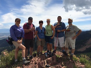
This was a great recreational hike, lots of uphill but nothing overly strenuous. Hikers should be in shape to keep up a good pace for the 2.25 miles of uphill. When you reach the Crest Trail (green line on the maps) there isn't much of a trail to the summit. Other's in my group found a trail up the hill but I bushwhacked my way to the ridge contouring to the right a bit and then followed the crown of the ridge to the top.
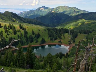
The photo of Lake Desolation was taken from the ridge about a quarter mile northwest of the summit. It is a rough ridgeline to follow but the view of the lake is very nice. We followed the ridge until we were just above the Crest Trail and took it back to the junction before heading home, that's the notch in the elevation profile below.
Photos
GPS Tracks: kml gpx
Google Maps: Terrain


No comments:
Post a Comment