Sunday, September 28, 2008

Tri-peak Loop: Millicent, Wolverine & Tuscarora Peaks


Ever since the Sunset Peak hike I wanted to return to Brighton and do some more peaks in the area. I noticed on Google Earth that these three peaks are close together and all hikable. Justin and I left the Brighton ski resort parking lot at about 8:30am, it was much warmer than two weeks before when I hiked Sunset Peak.

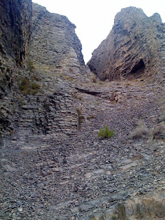
The walk up the road to the top of Millicent lift was a typical forest service road. At the top of the lift I looked up and saw that what looked like a nice hill on Google Earth was a boulder pile that would require a long scramble to the top. I had been hoping for a trail. We made it to the top in fairly good time. We only stopped to look at some big device mounted on the mountain side that we figured must be something to do with avalanche control.

Millicent Peak had a great view, stay tuned for a nice panorama which I need to stitch. 360 degrees of incredible alpine scenery. We quickly enjoied the view, took photos and headed on to the next peak.

What looked on Google Earth like a nice flat meadow between the peaks was really a steep hillside. The terrain was great for walking and we quickly reached Wolverine Peak. We relaxed to eat lunch while we enjoyed the view. The temperature began to drop quickly. We finished lunch, added a few layers and took more photos, we were on the peak for almost and hour.

Just as we headed off to tackle the third peak a thunderstorm materialized right above us. We were on the somewhat exposed pass between Wolverine and Tuscarora peaks as the lighting and thunder started. We took shelter between the rocky ridge and trees to wait out the storm. Though it materialized quickly it felt like the storm was holding still right above us. There were blue skys all around except right above our heads. I didn't want to abandon the attempt on the third peakbut the storm just wasn't moving after a 30 min wait. We retreated back towards Wolverine down in the trees in the center of the three peaks. We found I nice spot to hold up and wait a bit longer. After about 20 min the storm finnaly cleared above Tuscarora Peak so we headed out.

The rest of the walk towards Tuscarora was short. I was still nervous about lighting so I quickly visited the top of the peak and moved down. Before heading down we chatted with a couple that had come up from Cathrine Pass to Tuscarora. They were avid hikers and had been al over Utah. I got a few hike ideas from them for the future.

It was another short walk down to Cathrine Pass were we doffed the extra layers we had added at Wolverine Peak and had a snack at the pass. We started seeing lots of other hikers on the trails. We started down on the well worn Brighton Lakes Trail. We saw more and more other hikers as we hiked down to the the trail head. At Lake Mary there was dozens of people emerging from the trail to the open area near the dam.

After a few photos we continued on down to the parking lot. The trail from Lake Mary to the parking lot is busy, wide and well worn.

Length: 5.4 miles
Trail head: 8625 ft
Millicent Peak: 10,452 ft
Wolverine Peak: 10,795 ft
Tuscarora Peak: 10,640 ft

Photos: Flickr
GPS Tracks: kml gpx

At a 'machine' on the side Millicent Mountain above Brighton ski resort

Where is the trail.

Heading up Millicent Mountain from the top of the lift.

Saturday, September 27, 2008

B-25 Wreck on Timpanogos Mountain


Description Coming Soon
Time: 2:30 to the wreck from Timpooneke
Photos: Flickr
GPS Tracks: kml gpx

Wednesday, September 24, 2008

Saturday, September 20, 2008

Murdock Mountain Summit


This was a good idea for a second hike of the day after Bald Mountain Peak since it is the other side of the pass and is very high. The only problem was the weather, scattered thunder storms and at this altitude, snow.

The weather was so bad when we finished Bald Mountain Peak (we got sprinkled with rain and snow on the way down) I decided to skip this hike altogether. I did want to explore a bit and take pictures so I left my day pack in the car and took only my camera and a water bottle to walk around the Bald Mountain Peak trailhead area.

We explored around the pass for a bit, I wanted to take a nice panorama of Bald Mountain so we ventured to the south near Murdock Mountain. We climbed up the talus enough to get above the trees at the pass but thunder and precipitation kept us from going very far up. As we skirted the trees to the west the weather started clearing up and the mountain looked trivial. We started for the summit near the west end picking our way up the not too steep talus mountain side. The talus varied greatly from small boulders to grassy spots with some soil. Nutmeg had a bit of trouble getting across the uneven surface in the rougher spots. There were a few patches of low trees here and there but nothing to provide any real shelter.

As is usually the case, the improving weather started turning worse as we got close to the summit. There were a few cairns at the high spot but it was hard to tell which one was the highest. Just as I was judging the piles thunder started in the distance. I unleashed Nutmeg and we hurried off the Mountain. Nutmeg had a hard time keeping up with me and we started getting a significant amount of snow falling on us. A few times the talus got wet from rain and snow and became very slippery. Luckily it dried out as fast as it got we and we were able to get down to the the tall trees fairly quickly. I was quite nervous about lightning and felt very exposed on the talus mountainside.

As you can see from the map above, we looped around and saw a lot of the mountain and pass area. The pass has a lot of interesting but hikable terrain with many low rock ledges around the trees. BY the time we got back to the track at the Bald Mountain Peak trail head we were fairly wet and cold.

GPS Tracks: kml gpx

Bald Mountain Peak


Having driven highway 150 dozens of times, I always think I should hike up Bald Mountain (the peak to the north at the pass). I finally made the time and took Nutmeg with me to scratch this item off my bucket list.

The weather was threatening the whole hike, We did get sprinkled and snowed on just a tiny bit. The trail is a fairly well maintained forest service trail. It switches back a few times at the base of the mountain and then cuts up to the west to the west end of the ridge. The trail then mostly follows the ridge up to the peak. There is one spot where the trail switched back on the south side of the ridge to get up the last big rise. There are a few bands of trees on the ridge near the west end that the trail passes through. I saw a few mountain goats down on the south face when we got near the peak. They moved out of site before I could snap a photo.

Though the sign at the bottom said two miles, my GPS said 1.3 to the peak. I got up in about 51 min and stayed at the top for about 15 min to take photos. I wanted to get down before a storm rolled in. I got down in about the same time since I took time to take photos along the way and stopped to chat with a few groups headed up. Of the 4 groups on the mountain including us, 3 of us had a dog.

The 1200 ft of vertical to the peak makes for a steep climb but the quality of the trail helps a lot. This would make a great leg stretcher for a long drive on highway 150. The peak is quite high, almost 12,000 ft but the trail starts at about 10,800 ft so you get a big head start just driving up to the pass.

There are a lot of mountains and peak with "Bald" int he name. This is the third one that I have climbed this year. There are several more in the Little/Big Cottonwood Canyon area.

GPS Tracks: kml gpx


Other links:
Map: http://climb-utah.com/Uinta/Maps/bald%20mtn.jpg
Info: http://climb-utah.com/Uinta/bald.htm

Nutmeg and I were wet from snow on our way down Murdock Mountain

Sunday, September 14, 2008

Sunset Peak


Yulin, my daughter Carley, her boyfriend Josh and I got any early start for this hike I had been waiting several months to tackle. I had planned it earlier int he summer but called it off when I found out dogs were not allowed. Since I really wanted to hike this peak and had read about it I left Nutmeg at home. She was very sad but I had taken her up Provo Peak the day before.

This was a very nice hike. The trail is mostly pleasant with a few rocky spots on after Lake Mary and near the peak. The views are wonderful and I really enjoyed walking through the tall trees. There were a lot of people walking up on our trip down. We started up a little after 8am and there was still frost before we got into the direct sunlight.

The first part climbs up the Brighton Ski Resort ski slopes from the main lodge. It is a very smooth trail which we saw people of all ages walking up on our way back. Anyone should be able to make it up the short hike to Lake Mary. The second part approaches the Lake Mary dam passing through stands of tall trees. The view as you get to the edge of the lake gets lots of Owww's and Ahhh's. The trail along Lake Mary and to Martha Lake is a little bit more difficult. There are a few spots you most climb over rocks, nothing too bad but you wouldn't want to bring a stroller. Martha Lake is smaller but also worth a stop for photos. The trail from Martha Lake to 'the saddle' switches back in the trees, crosses a long meadow near Cathrine Lake and then climbs the ridge on an open hillside trail. Very tall signs at the saddle give you an idea how deep the snow gets in the winter. The Trail follows the ridge first to the Sunset Overlook and then towards the peak. The final sections of the trail continue to follow the ridge, circle the peak top and then scale the final short rise. From the parking lot to the peak took us 2 hours with plenty of breaks for pictures and water.

We ate our lunch on the peak and greeted a few other groups as they came up to the summit. We took pictures of a few friendly chipmunks begging for crumbs as we ate. The walk down took about 1.5 hours with a lot of traffic on the trail in the uphill direction. We clearly were early birds this day.

GPS Tracks: kml gpx
Photos: Flickr

You know who

Carley & Josh at the summit of Sunset Peak

Carley & Josh at Lake Mary

Josh and Carley

Sunday, September 7, 2008

Mount Timpanogos from Timpooneke


Despite plenty of prior notice, the group for the big Timpanogos hike consisted of only thee hikers, Mel, Kirk and me. At Kirk's request we planned a very early meet-up at 5:00am in the Timpooneke trailhead parking lot. The lot was almost full and several other small groups, mostly college aged, were heading out or meeting up. After finding each other in the pitch black darkness we headed out on the trail at 5:10am.
The temperature was very cool as we started hiking but the exertion kept me warm in just a long sleeve t-shirt but gloves were crucial for me to keep warm. Unfortunately the darkness prevented us from enjoying much of the scenery for the first hour of so of the hike.
When we arrived at 'The Saddle' in just 3.5 hours we were all very pleased. Mel had decided that she would make a decision to summit if she made it to the saddle in less than 5 hours. Not only did we blow that time away she and the other two of us felt great. We took a 15 min break for some energy food for the final push to the summit.
I was excited to better my previous time so put my head down and left Mel and Kirk behind on the final part of the climb. I had remembered struggling on this section last time but was able to keep up a good pace without stopping to catch my breath. I got to the summit in 4:38 with Mel and Kirk arriving about 10 min later.
There were lots of other hikers on the trail both going up and down. One thing I noticed was almost all of the hikers we saw on our way up were college aged. On our way down from the summit to the saddle we started seeing man more hikers older than college aged. I feel like we were near the front of the over 30 classification. We did see one older guy who was on his second trip up, for the day! He said he was training for the 'Bear 100' and was running the trail twice. Wow!
The trip down was much less enjoyable. We did get to see more scenery on the way down but the sore mussels and feet were catching up with us. We took one little sit down break on the decent but otherwise kept moving. The last few miles dragged on and on, we got back to the parking lot at 3:00pm. The ruggedness of the lower trail surprised me. We had climbed it in the dark with only head band lights. It looked treacherous in the light, I was amazed I didn't stumble and trip hiking it in the dark with only a little spot of light.

5:11am -  7200ft: Timpooneke Trailhead 
 8:56am - 11000ft: Arrive at the Saddle 
                   15 min Break
 9:12am - 11000ft: Depart the Saddle
 9:48am - 11720ft: Arrive on the Summit
                   41 min Break - Lunch
10:30pm - 11720ft: Depart the Summit 
 3:00pm -  7390ft: Arrive Trailhead

GPS Tracks: kml gpx
Photos: Flickr

Wednesday, September 3, 2008