
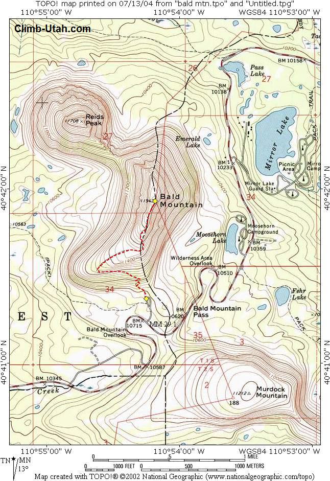
Having driven highway 150 dozens of times, I always think I should hike up Bald Mountain (the peak to the north at the pass). I finally made the time and took Nutmeg with me to scratch this item off my bucket list.
The weather was threatening the whole hike, We did get sprinkled and snowed on just a tiny bit. The trail is a fairly well maintained forest service trail. It switches back a few times at the base of the mountain and then cuts up to the west to the west end of the ridge. The trail then mostly follows the ridge up to the peak. There is one spot where the trail switched back on the south side of the ridge to get up the last big rise. There are a few bands of trees on the ridge near the west end that the trail passes through. I saw a few mountain goats down on the south face when we got near the peak. They moved out of site before I could snap a photo.
Though the sign at the bottom said two miles, my GPS said 1.3 to the peak. I got up in about 51 min and stayed at the top for about 15 min to take photos. I wanted to get down before a storm rolled in. I got down in about the same time since I took time to take photos along the way and stopped to chat with a few groups headed up. Of the 4 groups on the mountain including us, 3 of us had a dog.
The 1200 ft of vertical to the peak makes for a steep climb but the quality of the trail helps a lot. This would make a great leg stretcher for a long drive on highway 150. The peak is quite high, almost 12,000 ft but the trail starts at about 10,800 ft so you get a big head start just driving up to the pass.
There are a lot of mountains and peak with "Bald" int he name. This is the third one that I have climbed this year. There are several more in the Little/Big Cottonwood Canyon area.
GPS Tracks: kml gpx

Other links:
Map: http://climb-utah.com/Uinta/Maps/bald%20mtn.jpg
Info: http://climb-utah.com/Uinta/bald.htm

No comments:
Post a Comment